Jump to content

List of covered bridges in Maryland

From Wikipedia, the free encyclopedia

This is an old revision of this page, as edited by Transpoman (talk | contribs) at 22:49, 4 February 2021 (→‎List: Added name to coordinates for Foxcatcher Farm Covered Bridge). The present address (URL) is a permanent link to this revision, which may differ significantly from the current revision.

Map

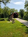
Below is a list of covered bridges in Maryland. There are six authentic covered bridges in the U.S. state of Maryland[1] of which five are historic. A covered bridge is considered authentic not due to its age, but by its construction. An authentic bridge is constructed using trusses rather than other methods such as stringers, a popular choice for non-authentic covered bridges.

List

Name Image County Location Built Length Crosses Ownership Truss Notes
Foxcatcher Farm Covered Bridge[2]

Foxcatcher Farm Covered Bridge

Cecil Fair Hill
39°42′35″N 75°50′15″W / 39.70972°N 75.83750°W / 39.70972; -75.83750 (Foxcatcher Farm Covered Bridge)
ca. 1860 80 feet (24 m) Big Elk Creek Burr Civil engineering landmark designated by the Maryland section in 1994.
Gilpin's Falls Covered Bridge[3] Gilpin's Falls Covered Bridge Cecil North East
39°38′55.8″N 75°57′20.1″W / 39.648833°N 75.955583°W / 39.648833; -75.955583 (Gilpin's Falls Covered Bridge)
ca. 1855 119 feet (36 m) North East Creek County of Cecil Burr
Jericho Covered Bridge[3] Bridge Baltimore and Harford Jerusalem and Kingsville
39°27′34″N 76°23′16″W / 39.45944°N 76.38778°W / 39.45944; -76.38778 (Jericho Covered Bridge)
1865, 1937 88 feet (27 m) Little Gunpowder Falls Counties of Baltimore and Harford Burr
Loys Station Covered Bridge[3] Loys Station Covered Bridge Frederick Thurmont
39°36′26″N 77°21′8″W / 39.60722°N 77.35222°W / 39.60722; -77.35222 (Loys Station Covered Bridge)
ca. 1860, rebuilt 1994[2] 90 feet (27 m) Owens Creek County of Frederick Multiple king Original bridge destroyed by arson in 1991
Roddy Road Covered Bridge[3] Roddy Road Covered Bridge Frederick Thurmont
39°38′26″N 77°23′39″W / 39.64056°N 77.39417°W / 39.64056; -77.39417 (Roddy Road Covered Bridge)
ca. 1860, rebuilt 2017[4] 39 feet (12 m) Owens Creek County of Frederick King
Utica Covered Bridge[3] Utica Covered Bridge Frederick Thurmont
39°31′28″N 77°23′46″W / 39.52444°N 77.39611°W / 39.52444; -77.39611 (Utica Covered Bridge)
ca. 1860 100 feet (30 m) Fishing Creek County of Frederick Burr

See also

References

  1. ^ "Gilpin's Falls Covered Bridge". Maryland's National Register Properties. Maryland Historical Trust. Retrieved 2 May 2020.
  2. ^ a b Wright, David W. (2009). World Guide to Covered Bridges (2009 ed.). Concord, New Hampshire: National Society for Preservation of Covered Bridges. p. 39. ISBN 978-0-692-00617-7.
  3. ^ a b c d e "National Register Information System". National Register of Historic Places. National Park Service. July 9, 2010.
  4. ^ "Updates to the 2009 World Guide to Covered Bridges" (PDF). National Society for Preservation of Covered Bridges. 19 February 2020. Retrieved 24 May 2020.

External links