Gothatuwa
Appearance
Gothatuwa
ගොතටුව கொதட்டுவ | |
|---|---|
Suburb | |
| Coordinates: 6°55′22.61″N 79°54′48.18″E / 6.9229472°N 79.9133833°E | |
| Sri Lanka | Western Province |
| District | Colombo |
| Divisional Secretariat | Kolonnawa |
| Government | |
| • Pradeshiya Sabha | Kotikawatta Mulleriyawa |
| Time zone | UTC+05:30 (SLST) |
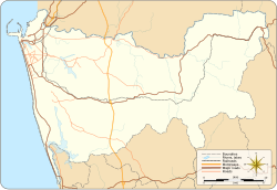
Gothatuwa (Sinhala: ගොතටුව, Tamil: கொதட்டுவ) is a suburb of Colombo in the Western Province of Sri Lanka.[1] It is connected to Sri Lankan transport network by Gothatuwa-Pettah Road and Kohilawatta-Kollupitiya Road. Gothatuwa is 9 km (5.6 mi) from the Colombo.
References
- ^ "Gothatuwa Map - Map of Gothatuwa, Sri Lanka". LankaPropertyWeb.com.
See also


