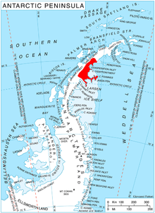
Dymcoff Crag

Dymcoff Crag (Template:Lang-bg, ‘Dymcoff Kamak’ \'dim-kov 'ka-m&k\) is the rocky, partly ice-free peak rising to 1360 m[1] in Lovech Heights on Nordenskjöld Coast in Graham Land. It surmounts Rogosh Glacier to the west and south. The feature is named after the Bulgarian engineer Nicolas Dymcoff (1861-1937), whose project ‘Étoile de la Concorde’ published in 1917 envisaged the establishment of a world organization for the preservation of peace and fostering cooperation among nations.
Location
Dymcoff Crag is located at 64°54′02″S 61°14′16″W / 64.90056°S 61.23778°W, which is 4 km southwest of Mount Persenk, 8.15 km north of Skilly Peak, and 6.9 km east of Kumanovo Peak in Ivanili Heights. British mapping in 1978.
Maps
- British Antarctic Territory. Scale 1:200000 topographic map. DOS 610 Series, Sheet W 64 60. Directorate of Overseas Surveys, Tolworth, UK, 1978.
- Antarctic Digital Database (ADD). Scale 1:250000 topographic map of Antarctica. Scientific Committee on Antarctic Research (SCAR). Since 1993, regularly upgraded and updated.
Notes
- ^ Reference Elevation Model of Antarctica. Polar Geospatial Center. University of Minnesota, 2019
References
- Dymcoff Crag. SCAR Composite Antarctic Gazetteer.
- Bulgarian Antarctic Gazetteer. Antarctic Place-names Commission. (details in Bulgarian, basic data in English)
External links
- Dymcoff Crag. Copernix satellite image
This article includes information from the Antarctic Place-names Commission of Bulgaria which is used with permission.
