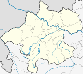
Helfenberg
Appearance
Helfenberg | |
|---|---|
 Location in the district | |
| Coordinates: 48°32′36″N 14°08′33″E / 48.54333°N 14.14250°E | |
| Country | Austria |
| State | Upper Austria |
| District | Rohrbach |
| Government | |
| • Mayor | Josef Hinterberger (ÖVP) |
| Area | |
• Total | 9.61 km2 (3.71 sq mi) |
| Elevation | 567 m (1,860 ft) |
| Population (14 June 2016)[1] | |
• Total | 1,004 |
| • Density | 100/km2 (270/sq mi) |
| Time zone | UTC+1 (CET) |
| • Summer (DST) | UTC+2 (CEST) |
| Postal code | 4184 |
| Area code | 0 72 16 |
| Vehicle registration | RO |
| Website | www.helfenberg.at |
Helfenberg is a municipality in the district of Rohrbach in the Austrian state of Upper Austria.
Population
[edit]| Year | Pop. | ±% |
|---|---|---|
| 1869 | 1,270 | — |
| 1880 | 1,171 | −7.8% |
| 1890 | 1,091 | −6.8% |
| 1900 | 1,118 | +2.5% |
| 1910 | 1,009 | −9.7% |
| 1923 | 1,006 | −0.3% |
| 1934 | 1,154 | +14.7% |
| 1939 | 1,112 | −3.6% |
| 1951 | 1,125 | +1.2% |
| 1961 | 1,143 | +1.6% |
| 1971 | 1,194 | +4.5% |
| 1981 | 1,141 | −4.4% |
| 1991 | 1,116 | −2.2% |
| 2001 | 1,053 | −5.6% |
| 2011 | 961 | −8.7% |
| 2017 | 989 | +2.9% |
References
[edit]Wikimedia Commons has media related to Helfenberg, Upper Austria.


