Red Flag Lake (Zhenning County)
Appearance
| Red Flag Lake | |
|---|---|
| Red Flag Reservoir | |
| 红旗湖 (Chinese) | |
| Location | Zhenning Buyei and Miao Autonomous County, Guizhou, China |
| Coordinates | 26°04′49″N 105°46′35″E / 26.080191°N 105.776436°E |
| Type | Artificial lake |
| Primary outflows | Zhenning River |
| Basin countries | China |
| Surface area | 5 square kilometres (1,200 acres) |
| Max. depth | 10.8 m (35 ft) |
| Water volume | 832,600 m3 (0.0001998 cu mi) |
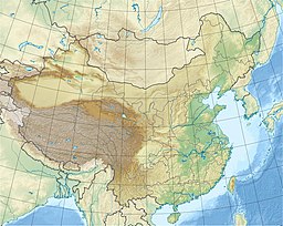
Red Flag Lake (simplified Chinese: 红旗湖; traditional Chinese: 紅旗湖; pinyin: Hóngqí Hú), also known as Red Flag Reservoir (红旗水库; 紅旗水庫; Hóngqí Shuǐkù), is an artificial lake in Zhenning Buyei and Miao Autonomous County, Guizhou, China. It covers a total surface area of 5 km2 (1.9 sq mi) and has a storage capacity of some 832,600 m3 (0.0001998 cu mi) of water. The lake discharges into the Zhenning River.
Function
The lake provides drinking water and water for irrigation.
Dam
The dam is 10.8 m (35 ft) high and made of stones.
Picture
References
- 镇宁布依族苗族自治县概况 [General Situation of Zhenning Buyei and Miao Autonomous County] (in Chinese). Beijing: Nationalities Publishing House. 2008. ISBN 9787105085859.


