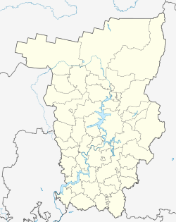
Nizhny Lyp
Appearance
Nizhny Lyp
Нижний Лып | |
|---|---|
Selo | |
| Coordinates: 57°20′N 54°13′E / 57.333°N 54.217°E[1] | |
| Country | Russia |
| Region | Perm Krai |
| District | Bolshesosnovsky District |
| Time zone | UTC+5:00 |
Nizhny Lyp (Russian: Нижний Лып) is a rural locality (a selo) in Polozovoskoye Rural Settlement, Bolshesosnovsky District, Perm Krai, Russia. The population was 315 as of 2010.[2] There are 6 streets.
Geography
Nizhny Lyp is located 54 km southwest of Bolshaya Sosnova (the district's administrative centre) by road. Kozhino is the nearest rural locality.[3]
References
- ^ Карта села Нижний Лып в Пермском крае
- ^ "ВПН-2010. Численность и размещение населения Пермского края". Archived from the original on 2014-09-10. Retrieved 2019-03-29.
- ^ Расстояние от Нижнего Лыпа до Большой Сосновы


