Dhzurla
Appearance
This article needs additional citations for verification. (May 2017) |
| Dhzurla | |
|---|---|
 | |
 | |
| Location | Crimean Mountains, Crimea, Template:In Crimea |
| Coordinates | 44°46′4.73″N 34°25′31.04″E / 44.7679806°N 34.4252889°E |
| Elevation | 820 metres (2,690 ft) |
| Total height | 6 metres (20 ft) |
| Watercourse | Dhzurla river |
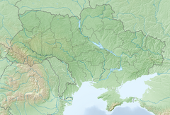
Dhzurla (Template:Lang-uk) waterfall is located on the Dhzurla river in the Crimean Mountains of Crimea. Waterfall height is about 6 metres (20 ft). Waterfall has a few cascades. The word “Dhzurla” from Crimean Tatar language which means “her, who runs."[unreliable source?]
Downstream river is called Soter.[1]
See also
References
- ^ Гончаров, Владлен Петрович (1971). Демерджи. Симферополь: Крым. p. 28.


