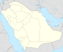
Al Hamra (Riyadh)
Appearance
This article needs additional citations for verification. (June 2021) |
Al Hamra | |
|---|---|
District | |
| Coordinates: 24°46′37.065″N 46°45′9.667″E / 24.77696250°N 46.75268528°E | |
| Country | |
| Province | Al Riyadh Province |
| Government | |
| • Body | Baladiyah Al Rawdah |
| Time zone | UTC+3 (EAT) |
| • Summer (DST) | UTC+3 (EAT) |
Al Hamra'a (aka Al Hamra; Arabic: الحمراء) is a subject of Baladiyah al-Rawdah and a neighborhood in Riyadh, Saudi Arabia.[1]
Located in the northeastern part of the city, Al Hamra'a hosts a number of sites and local landmarks, such as Al Hamra'a Park, Al Hokair Land, Star City Park, Al Marsa Resorts, Riyadh Najed Schools, Sanad Hospital, Jarir Bookstore, The Water Splash, etc.[citation needed]
Landmarks
[edit]The following are landmarks in Al Hamra'a:[citation needed]
- Al Hamra Park
- Al Hokair Land
- Star City Park
- Al Marsa Resorts
- The Water Splash
- Riyadh Najed Schools
- Sanad Hospital
- El Seif Engineering
- Jarir Bookstore
References
[edit]- ^ "Al Hamra – Riyadh, Saudi Arabia". Chapman Taylor. Retrieved 27 June 2021.

