Martin Down Enclosure
 Looking north-west across the site | |
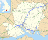
| Location | Martin Down, Hampshire |
|---|---|
| Coordinates | 50°58′47″N 1°56′24″W / 50.97972°N 1.94000°W |
| OS grid reference | SU 043 200 |
| History | |
| Periods | Bronze Age Romano-British |
| Site notes | |
| Excavation dates | 1895–1896 |
| Archaeologists | Augustus Pitt Rivers |
| Designated | 20 October 1936 |
| Reference no. | 1010870 |
The Martin Down Enclosure is an archaeological site on Martin Down, near the village of Martin, in Hampshire, England. It is near the boundaries with Dorset and Wiltshire.
The site is a scheduled monument,[1] and it is one of several archaeological features on Martin Down, such as Bokerley Dyke.[2]
The enclosure is the original example of a type of prehistoric feature, the "Martin Down style enclosure": they are small enclosures of the Bronze Age, area often less than 0.3 hectares (0.74 acres), considered to be domestic settlements. They have mostly been found on downland of central southern England, usually situated on hillsides.[3] Other examples are on Harrow Hill and Thundersbarrow Hill, both in West Sussex, South Lodge in Wiltshire, and on Shearplace Hill in Dorset.
Description
[edit]There was excavation by Augustus Pitt Rivers from November 1895 to March 1896.[4] He excavated all of the bank and ditch, and about half of the interior; the present earthwork is his reconstruction. It was concluded that the site is middle Bronze Age, with later Romano-British occupation. Finds from the excavation included worked flint, animal bone and pottery of the Bronze Age and Romano-British period.[1]
The rectangular enclosure has internal dimensions of about 90 metres (300 ft) south-west to north-east by 63 metres (207 ft). It has a single bank of width up to 10 metres (33 ft) and up to 0.7 metres (2 ft 4 in) above the interior, and there is an external ditch. There is a gap (established as original during the excavation) at the eastern end of the north side, width about 40 metres (130 ft), and there are entrances on the east and south sides.[1]
Excavations by Pitt Rivers
[edit]Other sites on Cranborne Chase excavated by Pitt Rivers include the Rotherley Down Settlement, South Lodge Camp, Woodcutts Settlement and Wor Barrow.
References
[edit]- ^ a b c Historic England. "Bronze Age and Romano-British enclosure on Martin Down, east of Bokerley Junction (1010870)". National Heritage List for England. Retrieved 29 July 2020.
- ^ Historic England. "Bokerley Dyke, and a section of Grim's Ditch, a section of a medieval boundary bank, and two bowl barrows on and north west of Martin Down (1012135)". National Heritage List for England. Retrieved 30 July 2020.
- ^ Historic England. "Martin Down style enclosure, bowl barrow, Iron Age hillfort, Romano-British village and associated field system on Thundersbarrow Hill (1015124)". National Heritage List for England. Retrieved 30 July 2020.
- ^ Historic England. "Martin Down Camp (214336)". Research records (formerly PastScape). Retrieved 29 July 2020.

