Clonskeagh Bridge
Appearance
Clonskeagh Bridge | |
|---|---|
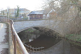
 Clonskeagh Bridge seen from upstream on the left bank. | |
| Coordinates | 53°18′49″N 6°14′18″W / 53.313538°N 6.238288°W |
| Crosses | River Dodder |
| Characteristics | |
| Material | Stone |
| No. of spans | 1 |
| History | |
| Construction end | Unknown |
| Location | |
 | |
Clonskeagh Bridge is a bridge over the River Dodder in Dublin, Ireland.[1] The bridge is on the Clonskeagh Road and forms part of the administrative boundary between Dublin City Council and Dún Laoghaire-Rathdown County Council
References
- ^ Chapters of Dublin - Bridges Archived October 4, 2012, at the Wayback Machine
External links
