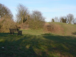
Owston Ferry Castle
Appearance
This article includes a list of general references, but it lacks sufficient corresponding inline citations. (January 2009) |
| Owston Ferry Castle | |
|---|---|
| Owston Ferry | |
 | |
| Coordinates | 53°29′32″N 0°47′12″W / 53.4923°N 0.7866°W |
| Grid reference | grid reference SE806002 |
| Site information | |
| Controlled by | North Lincolnshire Council |
| Open to the public | yes |
| Condition | ruin |
| Site history | |
| Built | c. 1070 rebuilt: 1174 |
| Demolished | 1095, 1174 |
| Battles/wars | Revolt of 1173–74 |
Owston Ferry Castle (also known as Kinnard's Ferry Castle) was in the village of Owston Ferry, some 12 kilometres (7 mi) to the north of Gainsborough, Lincolnshire.
It is thought that the original castle on this site was erected soon after the Norman Conquest but that it was dismantled in 1095. It was rebuilt in 1173 by Roger de Mowbray to support Prince Henry in the conflict with his father Henry II who subsequently had the castle destroyed.[1]
The site of the motte remains as a broad grassy mound. The surrounding area is now a Local Nature Reserve.[2][3][4]
References
- ^ "Owston Ferry Castle". Gatehouse website. Retrieved 7 August 2012.
- ^ "Owston Ferry Castle Nature Reserve". North Lincolnshire Council. Retrieved 15 March 2013.
- ^ "Owston Ferry Castle". Local Nature Reserves. Natural England.
- ^ "Map of Owston Ferry Castle". Local Nature Reserves. Natural England.
Further reading
- Fry, Plantagenet Somerset (1980). The David & Charles Book of Castles. David & Charles. p. 249. ISBN 0-7153-7976-3.

