Jump to content

Mont Durand Glacier

Coordinates: 45°55′13″N 7°19′49″E / 45.92028°N 7.33028°E / 45.92028; 7.33028
From Wikipedia, the free encyclopedia

This is the current revision of this page, as edited by Fadesga (talk | contribs) at 17:41, 8 May 2022 (→‎References). The present address (URL) is a permanent link to this version.

(diff) ← Previous revision | Latest revision (diff) | Newer revision → (diff)
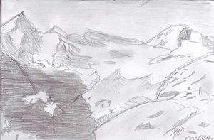
Mont Durand Glacier, drawing by Jasmin Nelly Weidmann

The Mont Durand Glacier (French: Glacier du Mont Durand) is a 5.9 km long glacier (2005) situated in the Grand Combin massif, Pennine Alps, in the canton of Valais in Switzerland. In 1973 it had an area of 7.5 km².[1]

See also

[edit]

References

[edit]
  1. ^ "MDG". Swiss Glacier Monitoring Network.

45°55′13″N 7°19′49″E / 45.92028°N 7.33028°E / 45.92028; 7.33028