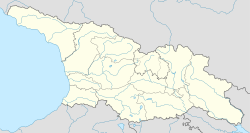
Nigoiti
Appearance
Nigoiti
ნიგოითი | |
|---|---|
| Coordinates: 42°04′59″N 42°06′29″E / 42.08306°N 42.10806°E | |
| Country | |
| Mkhare | Guria |
| District | Lanchkhuti |
| Elevation | 40 m (130 ft) |
| Population (2014) | |
| • Total | 615 |
| Time zone | UTC+4 (Georgian Time) |
Nigoiti (Georgian: ნიგოითი) is a village in the Lanchkhuti Municipality of Guria in western Georgia with the population of 615 (2014).[1] In 1854, during the Crimean War, the Battle of Nigoiti was fought nearby between the Ottoman Empire and Russian Empire.[2]
References
[edit]- ^ "მოსახლეობის საყოველთაო აღწერა 2014". საქართველოს სტატისტიკის ეროვნული სამსახური. November 2014. Retrieved 7 November 2016.
- ^ Georgian Soviet Encyclopedia Vol. 7, p. 412, 1984.


