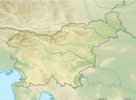
Frischauf Lodge at Okrešelj
Appearance
| Frischauf Lodge at Okrešelj | |
|---|---|
| (Frischaufov dom na Okrešlju) | |
| Highest point | |
| Elevation | 1,378 m (4,521 ft) |
| Coordinates | 46°22′14.880″N 14°35′28.680″E / 46.37080000°N 14.59130000°E |
| Geography | |
| Location | Slovenia |
| Parent range | Kamnik–Savinja Alps |
The Frischauf Lodge at Okrešelj (Template:Lang-sl; 1,378 meters or 4,521 feet) is a mountain lodge that stands above the Logar Valley in northern Slovenia. It is surrounded by the following peaks: Cold Mountain (Mrzla gora), Styria Mount Rinka (Štajerska Rinka), Carinthia Mount Rinka (Koroška Rinka), and Mount Turska (Turska gora). Nearby is 80-meter (260 ft) Rinka Falls. The lodge is named after Johannes Frischauf, and the first lodge was built in 1876 by an Austro-German hiking club. In 1907 it was destroyed by an avalanche and rebuilt again in 1908. In 1991 it was expanded and modernized.
Starting points
- 1 h: from the Logar Valley Hikers' Lodge (Dom planincev v Logarski dolini; 837 m or 2,746 ft)
Neighbouring lodges
- 1½ h : to the Kamnik Saddle Lodge (Koča na Kamniškem sedlu; 1,864 m or 6,115 ft)
- 5½ h : to the Zois Lodge at Kokra Saddle (Cojzova koča na Kokrskem sedlu; 1,793 m or 5,883 ft), via Turski Žleb Ravine and the Sleme Pass
- 4 h: to the Kranj Lodge at Ledine (Kranjska koča na Ledinah; 1,700 m or 5,600 ft), via Savinja Saddle (Savinjsko sedlo)
Neighbouring peaks
- 2½ h: Brana (2,252 m or 7,388 ft)
- 3½ h: Carniola Mount Rinka (Kranjska Rinka; 2,453 m or 8,048 ft)
- 3½ h: Cross (Križ; 2,433 m or 7,982 ft)
- 3½ h: Cold Mountain (Mrzla gora, 2,203 m or 7,228 ft)
- 4 h: Skuta (2,532 m or 8,307 ft)
- 3½ h: Styria Mount Rinka (Štajerska Rinka; 2,289 m or 7,510 ft)
- 2 h: Mount Turska (2,251 m or 7,385 ft)
See also
References
- Slovenska planinska pot, Planinski vodnik, PZS, 2012, Milenko Arnejšek - Prle, Andraž Poljanec ISBN 978-961-6870-04-7
External links

