Barnaulka
| Barnaulka Барнаулка | |
|---|---|
 View of the river | |
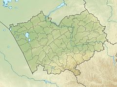
Mouth location in Altai Krai, Russia | |
| Location | |
| Country | Russia |
| Physical characteristics | |
| Source | Lake Zerkalnoye |
| • coordinates | 52°33′21″N 81°57′10″E / 52.55583°N 81.95278°E |
| Mouth | Ob |
• location | Barnaul |
• coordinates | 53°19′47″N 83°48′18″E / 53.32972°N 83.80500°E |
| Length | 207 km (129 mi) |
| Basin size | 5,720 km2 (2,210 sq mi) |
| Basin features | |
| Progression | Ob→ Kara Sea |
The Barnaulka (Template:Lang-ru) is a river in Altai Krai, Russia. The river is 207 kilometres (129 mi) long and has a catchment area of 5,720 square kilometres (2,210 sq mi).[1]
The basin of the river is located in the Rebrikhinsky, Shipunovsky and Pavlovsky districts. The city of Barnaul is named after the river.[2] The Barnaulka suffers from the impact of pollutants released by industrial activity along its course.[3]
Course
The Barnaulka is a left tributary of the Ob river. It has its sources in Zerkalnoye, a lake with a 18 square kilometres (6.9 sq mi) surface lying 60 km (37 mi) to the west of Aleysk. The upper course of the river is a chain of lakes connected by marshy canals located in the Ob Plateau (Приобское плато). There are numerous swamps and smaller lakes in its basin. The Barnaulka flows in a roughly northeastern direction. Finally it meets the left bank of the Ob at Barnaul, 3,409 km (2,118 mi) from the Ob's mouth.[4]
Tributaries
The longest tributary of the Barnaulka is the 18 km (11 mi) long Vlasikha (Власиха) on the left. The river is largely fed by groundwater. It is frozen between November and April.[1][5]
See also
References
- ^ a b "Река БАРНАУЛКА in the State Water Register of Russia". textual.ru (in Russian).
- ^ "50 ФАКТОВ О БАРНАУЛЕ". 50factsbarnaul.amic.ru. Archived from the original on 2016-04-05. Retrieved 2016-03-06.
- ^ Effect of Anthropogenic Pollution on Macrozoobenthos Structure in Barnaulka River (Upper Ob Basin)
- ^ "N-44-Г Topographic Chart (in Russian)". Retrieved 23 June 2022.
- ^ Google Earth
External links
 Media related to Barnaulka at Wikimedia Commons

