Rock Sound International Airport
Appearance
Rock Sound International Airport | |||||||||||
|---|---|---|---|---|---|---|---|---|---|---|---|
| Summary | |||||||||||
| Location | Rock Sound | ||||||||||
| Elevation AMSL | 10 ft / 3 m | ||||||||||
| Coordinates | 24°53′30″N 076°10′40″W / 24.89167°N 76.17778°W | ||||||||||
| Map | |||||||||||
 | |||||||||||
| Runways | |||||||||||
| |||||||||||
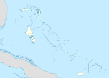
Rock Sound International Airport (IATA: RSD, ICAO: MYER) is an airport in the South Eleuthera district of The Bahamas. Its name comes from the former district of Rock Sound.
Airlines and destinations
| Airlines | Destinations |
|---|---|
| Bahamasair | George Town, Governor's Harbour, Nassau, San Salvador |
Historically, Rock Sound was served by Pan Am beginning the mid-1960s with Boeing 707 and Boeing 727 jetliner service to Miami and New York JFK Airport via an intermediate stop in Nassau.[2] The airport is one of the very few in The Bahamas to have received such mainline jet service. In addition, during the late 1970s, Air Florida served the airport with Boeing 737 jetliners with nonstop flights to Miami.[3] Lauda Air Italy also flew weekly charters to Milan for a brief period in 2001.
References
- ^ "Airport information for MYER". World Aero Data. Archived from the original on 5 March 2019.
{{cite web}}: CS1 maint: unfit URL (link) Data current as of October 2006. Source: DAFIF. - ^ "pa66-15.jpg". Airline Timetable Images.
- ^ http://www.departedflights.com, Nov. 15, 1979 Official Airline Guide (OAG), Miami-Rock Sound schedules

