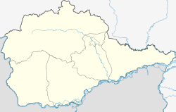
Obluchye, Jewish Autonomous Oblast
Obluchye
Облучье | |
|---|---|
| Coordinates: 49°01′N 131°03′E / 49.017°N 131.050°E | |
| Country | Russia |
| Federal subject | Jewish Autonomous Oblast[1] |
| Administrative district | Obluchensky District[1] |
| Founded | 1911 |
| Town status since | 1938 |
| Elevation | 270 m (890 ft) |
| Population | |
| • Total | 9,379 |
| • Capital of | Obluchensky District[1] |
| • Municipal district | Obluchensky Municipal District[3] |
| • Urban settlement | Obluchenskoye Urban Settlement[3] |
| • Capital of | Obluchensky Municipal District,[4] Obluchenskoye Urban Settlement[3] |
| Time zone | UTC+10 (MSK+7 |
| Postal code(s)[6] | 679100, 679102, 679104, 679109 |
| Dialing code(s) | +7 42666 |
| OKTMO ID | 99620101001 |
Obluchye (Russian: Облу́чье, Yiddish: אָבלוטשיע) is a town and the administrative center of Obluchensky District in the Jewish Autonomous Oblast, Russia, located on the Khingan River, 159 kilometers (99 mi) west of Birobidzhan, the administrative center of the autonomous oblast. Population: 7,959 (2021 Census);[7] 9,379 (2010 Census);[2] 11,069 (2002 Census);[8] 12,016 (1989 Soviet census).[9]
History
Construction on a section of the Trans-Siberian Railway connecting Chita and Vladivostok began in 1898, starting at each end and meeting halfway. The project produced a large influx of new settlers and in 1911 a village was founded around the Obluchye railway station, the name of which roughly means the route passing around as the railway at this point travels through a large curve around the mountains.[citation needed]
The railway was completed in October 1916.[10]
Town status was granted to Obluchye in 1938.[citation needed]
Administrative and municipal status
Within the framework of administrative divisions, Obluchye serves as the administrative center of Obluchensky District, to which it is directly subordinated.[1] As a municipal division, the town of Obluchye, together with five rural localities in Obluchensky District, is incorporated within Obluchensky Municipal District as Obluchenskoye Urban Settlement.[3]
Economy
The gold mining company Zoloto Zutary is based in the town. Other employers include the railway workshops connected to the town's station on the Trans-Siberian Railway.
References
Notes
- ^ a b c d e Law #982-OZ
- ^ a b Russian Federal State Statistics Service (2011). Всероссийская перепись населения 2010 года. Том 1 [2010 All-Russian Population Census, vol. 1]. Всероссийская перепись населения 2010 года [2010 All-Russia Population Census] (in Russian). Federal State Statistics Service.
- ^ a b c d Law #338-OZ
- ^ Федеральная служба государственной статистики. Федеральное агентство по технологическому регулированию и метрологии. №ОК 033-2013 1 января 2014 г. «Общероссийский классификатор территорий муниципальных образований. Код 99 620 101». (Federal State Statistics Service. Federal Agency on Technological Regulation and Metrology. #OK 033-2013 January 1, 2014 Russian Classification of Territories of Municipal Formations. Code 99 620 101. ).
- ^ "Об исчислении времени". Официальный интернет-портал правовой информации (in Russian). June 3, 2011. Retrieved January 19, 2019.
- ^ Почта России. Информационно-вычислительный центр ОАСУ РПО. (Russian Post). Поиск объектов почтовой связи (Postal Objects Search) (in Russian)
- ^ Russian Federal State Statistics Service. Всероссийская перепись населения 2020 года. Том 1 [2020 All-Russian Population Census, vol. 1] (XLS) (in Russian). Federal State Statistics Service.
- ^ Federal State Statistics Service (May 21, 2004). Численность населения России, субъектов Российской Федерации в составе федеральных округов, районов, городских поселений, сельских населённых пунктов – районных центров и сельских населённых пунктов с населением 3 тысячи и более человек [Population of Russia, Its Federal Districts, Federal Subjects, Districts, Urban Localities, Rural Localities—Administrative Centers, and Rural Localities with Population of Over 3,000] (XLS). Всероссийская перепись населения 2002 года [All-Russia Population Census of 2002] (in Russian).
- ^ Всесоюзная перепись населения 1989 г. Численность наличного населения союзных и автономных республик, автономных областей и округов, краёв, областей, районов, городских поселений и сёл-райцентров [All Union Population Census of 1989: Present Population of Union and Autonomous Republics, Autonomous Oblasts and Okrugs, Krais, Oblasts, Districts, Urban Settlements, and Villages Serving as District Administrative Centers]. Всесоюзная перепись населения 1989 года [All-Union Population Census of 1989] (in Russian). Институт демографии Национального исследовательского университета: Высшая школа экономики [Institute of Demography at the National Research University: Higher School of Economics]. 1989 – via Demoscope Weekly.
- ^ "The Underground Map".
Sources
- Законодательное Собрание Еврейской автономной области. Закон №982-ОЗ от 20 июля 2011 г. «Об административно-территориальном устройстве Еврейской автономной области». Вступил в силу через 10 дней после дня официального опубликования. Опубликован: "Биробиджанская звезда", №54, 29 июля 2011 г. (Legislative Assembly of the Jewish Autonomous Oblast. Law #982-OZ of July 20, 2011 On the Administrative-Territorial Structure of the Jewish Autonomous Oblast. Effective as of the day which is 10 days after the day of the official publication.).
- Законодательное Собрание Еврейской автономной области. Закон №338-ОЗ от 2 ноября 2004 г. «О границах и статусе городских, сельских поселений в составе Облученского муниципального района», в ред. Закона №312-ОЗ от 5 июня 2013 г. «О преобразовании муниципальных образований "Пашковское сельское поселение" и "Раддевское сельское поселение" в составе Облученского муниципального района Еврейской автономной области и о внесении изменений в Закон Еврейской автономной области "О границах и статусе городских, сельских поселений в составе Облученского муниципального района"». Вступил в силу через 10 дней после дня официального опубликования. Опубликован: "Биробиджанер штерн", №92, 23 декабря 2004 г. (Legislative Assembly of the Jewish Autonomous Oblast. Law #338-OZ of November 2, 2004 On the Borders and Status of the Urban, Rural Settlements Within Obluchensky Municipal District, as amended by the Law #312-OZ of June 5, 2013 On the Transformation of the Municipal Formations of "Pashkovskoye Rural Settlement" and "Raddevskoye Rural Settlement" Within Obluchensky Municipal District of the Jewish Autonomous Oblast and on Amending the Law of the Jewish Autonomous Oblast "On the Borders and Status of the Urban, Rural Settlements Within Obluchensky Municipal District". Effective as of the day which is 10 days after the day of the official publication.).


