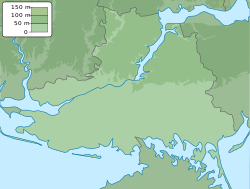
Bruskynske
Appearance
Bruskynske
Брускинське | |
|---|---|
| Coordinates: 47°09′27″N 33°12′34″E / 47.1575°N 33.209444°E | |
| Country | |
| Oblast | Kherson Oblast |
| Raion | Beryslav Raion |
| Founded | 1906 |
| Area | |
| • Total | 1.89 km2 (0.73 sq mi) |
| Elevation | 68 m (223 ft) |
| Population | |
| • Total | 436 |
| • Density | 230/km2 (600/sq mi) |
| Time zone | UTC+2 (EET) |
| • Summer (DST) | UTC+3 (EEST) |
| Postal code | 75121 |
| Area code | +380 5532 |
 | |
Bruskynske (Ukrainian: Брускинське; Russian: Брускинское) is a village in Beryslav Raion (district) in Kherson Oblast of southern Ukraine, at about 79.2 kilometres (49.2 mi) northeast by north from the centre of Kherson city.
The village came under attack by Russian forces in 2022, during the Russian invasion of Ukraine,[2] and was occupied until 11 November of the same year.[3]
References
- ^ Distribution of the population by native language on ukrcensus.gov.ua
- ^ "Russian Offensive Campaign Assessment, July 21". ISW. Retrieved 22 July 2022.
- ^ Chernichkin, Kostyantyn (13 November 2022). "Kherson celebrates liberation after 8 months of Russian occupation (PHOTOS)". The Kyiv Independent. Retrieved 11 December 2022.


