Agusalu
Appearance
Agusalu | |
|---|---|
Village | |
 | |
 | |
| Country | |
| County | Ida-Viru County |
| Parish | Alutaguse Parish |
| Time zone | UTC+2 (EET) |
| • Summer (DST) | UTC+3 (EEST) |
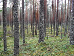
Agusalu is a village in Alutaguse Parish, Ida-Viru County in northeastern Estonia.[1] It is particularly known for the Agusalu Nature Reserve which encompasses a large proportion of the area. Its landscape is characterised by large bogs and is known for hosting the only system of continental sand dunes in Estonia.[2]
References
[edit]- ^ Classification of Estonian administrative units and settlements 2014[dead link] (retrieved 28 July 2021)
- ^ "No. 14583. Convention on wetlands of international importance especially as waterfowl habitat. Concluded at Ramsar, Iran, on 2 February 1971", Treaty Series 2013, United Nations Treaty Series, UN, pp. 524–525, 2001-11-22, doi:10.18356/76252740-en-fr, ISBN 9789210455435, retrieved 2021-09-07
59°06′N 27°39′E / 59.100°N 27.650°E

