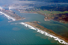
Daby Island
Appearance
| Geography | |
|---|---|
| Location | Northern California |
| Coordinates | 40°48′40″N 124°09′07″W / 40.8112°N 124.1520°W |
| Highest elevation | 3 ft (0.9 m) |
| Administration | |
| State | |
| County | Humboldt |
| City | Eureka |

Daby Island is an island in Humboldt Bay in Humboldt County, California.[1] Located east of Woodley Island, it is part of the city of Eureka and has an elevation of three feet.[2]
There are 28 historic landmarks near the island.[3]
References
[edit]- ^ "Daby Island". Geographic Names Information System. United States Geological Survey, United States Department of the Interior. Retrieved November 22, 2018.
- ^ "Daby Island". Mapcarta. Retrieved 2018-10-26.
- ^ "Daby Island, CA - Area Historical/Landmark Places of Interest". www.latlongwiki.com. Retrieved October 26, 2018.


