Hektoria Glacier

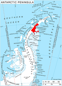
Hektoria Glacier (65°3′S 61°31′W / 65.050°S 61.517°W) is a glacier flowing south from the area around Mount Johnston between Mount Quandary and Zagreus Ridge into Vaughan Inlet next west of Brenitsa Glacier and east of Green Glacier, on the east coast of the Antarctic Peninsula.
The name "Hektoria Fiords" was given by Sir Hubert Wilkins during his flight of 20 December 1928, after the SS Hektoria, which had brought him to Deception Island. Following survey by the Falkland Islands Dependencies Survey (FIDS) in 1947, the feature could not be identified; however, during further survey by FIDS in 1955, Wilkins' "long ice-filled fiords" were found to be this glacier and two short unnamed ones.[1][2]
References
[edit]- ^ "Hektoria Glacier". Geographic Names Information System. United States Geological Survey, United States Department of the Interior. Retrieved 9 June 2012.
- ^ Alberts, Fred G., ed. (June 1995). Geographic Names of the Antarctic (PDF) (second ed.). United States Board on Geographic Names. p. 324. Retrieved 5 April 2012.
![]() This article incorporates public domain material from "Hektoria Glacier". Geographic Names Information System. United States Geological Survey.
This article incorporates public domain material from "Hektoria Glacier". Geographic Names Information System. United States Geological Survey.
