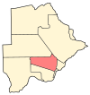
Mmanoko
Appearance
Mmanoko | |
|---|---|
| Coordinates: 24°28′41″S 25°39′56″E / 24.47806°S 25.66556°E | |
| Country | |
| District | Kweneng District |
| Population (2001) | |
| • Total | 763 |
Mmanoko is a village in Kweneng District of Botswana. It is located 31 km north-east of the capital of Botswana, Gaborone, along the Gaborone–Molepolole road. The population was 763 in 2001 census.[1]
References
[edit]- ^ "Distribution of population by sex by villages and their associated localities: 2001 population and housing census". Archived from the original on 24 November 2007. Retrieved 10 February 2008.
24°28′41″S 25°39′56″E / 24.47806°S 25.66556°E


