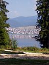
Tsvetino
Tsvetino
Цветино | |
|---|---|
Village | |
 | |
| Coordinates: 41°59′32.36″N 23°50′23.85″E / 41.9923222°N 23.8399583°E | |
| Government | |
| • Mayor | Plamen Pashaliev |
| Area | |
• Total | 6.82 km2 (2.63 sq mi) |
| Elevation | 1,031 m (3,383 ft) |
| Population | |
• Total | 131 |
| • Density | 19/km2 (50/sq mi) |
| Time zone | UTC+2 (EET) |
| • Summer (DST) | UTC+3 (EEST) |
Tsvetino (Template:Lang-bg) is a village located in Velingrad Municipality, Pazardzhik Province, Southern Bulgaria.[1]
The village of Tsvetino is located in a mountainous area 25 km southwest of Velingrad. Mainly potatoes are grown, due to harsh climate conditions in the area.
History
Tsvetino is considered an old village in the Chepino Valley, as it was first originated as a pastoral settlement. The people came to the village from Macedonia after a plague epidemic, which concludes that the people speak a Macedonian dialect.[2] Until 1979 the village was the centre of a municipality with 35 scattered neighborhoods and huts, and then it became a village with an mayor, even though its under the 350 people requirement.[2]
The old name is Florovo, deriving from the French word fleur, which means flower.[3]
References
- ^ "*** Guide Bulgaria *** - Village Tsvetino". Guide Bulgaria. Retrieved 2023-01-22.
- ^ a b "Флорово е било старото име на село Цветино". Велинград - Новини и актуална информация www.vip-velingrad.com (in Bulgarian). Retrieved 2023-01-22.
- ^ Марица, Екип (2017-02-06). "Как Флорово станало Цветино". marica.bg (in Bulgarian). Retrieved 2023-01-22.


