Brezje pod Nanosom
Appearance
Brezje pod Nanosom | |
|---|---|
 | |
| Coordinates: 45°46′24.67″N 14°5′28.16″E / 45.7735194°N 14.0911556°E | |
| Country | |
| Traditional region | Inner Carniola |
| Statistical region | Littoral–Inner Carniola |
| Municipality | Postojna |
| Area | |
• Total | 0.66 km2 (0.25 sq mi) |
| Elevation | 568.6 m (1,865.5 ft) |
| Population (2002) | |
• Total | 31 |
| [1] | |
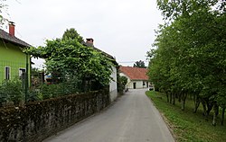
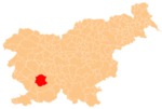
Brezje pod Nanosom (pronounced [ˈbɾeːzjɛ pɔt ˈnaːnɔsɔm]; Template:Lang-it) is a small settlement below the eastern slopes of Mount Nanos in the Municipality of Postojna in the Inner Carniola region of Slovenia.[2]
Name
The name of the settlement was changed from Brezje to Brezje pod Nanosom in 1953.[3]
References
- ^ Statistical Office of the Republic of Slovenia
- ^ Postojna municipal site
- ^ Spremembe naselij 1948–95. 1996. Database. Ljubljana: Geografski inštitut ZRC SAZU, DZS.
External links
 Media related to Brezje pod Nanosom at Wikimedia Commons
- Brezje pod Nanosom on Geopedia


