Gojo Bridge
Appearance
You can help expand this article with text translated from the corresponding article in Japanese. (December 2019) Click [show] for important translation instructions.
|
Gojo Bridge | |
|---|---|
 The bridge in 2014 | |
| Coordinates | 34°59′45″N 135°46′4″E / 34.99583°N 135.76778°E |
| Locale | Kyoto, Japan |
| Location | |
 | |
Gojō Bridge, or Gojō Ōhashi (五条大橋) Bridge, is a bridge in Kyoto, Japan, spanning the Kamo River. The current bridge was built in 1959.[1]
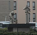
The original Gojō Bridge, located somewhat to the north, was known as the site of Minamoto no Yoshitsune's encounter and subsequent duel with Benkei. A sculpture near the current Gojō Bridge depicts the meeting.[2][3]
-
Nearby statues depicting Minamoto no Yoshitsune's encounter with Benkei
References
- ^ Asano, John (16 January 2017). "6 Must See Bridges in Kyoto". Culture Trip. Archived from the original on 2021-08-12. Retrieved 2021-08-12.
- ^ Strippoli, Roberta (2017-11-27). Dancer, Nun, Ghost, Goddess: The Legend of Giō and Hotoke in Japanese Literature, Theater, Visual Arts, and Cultural Heritage. ISBN 9789004356320. Archived from the original on 2021-05-04. Retrieved 2019-12-18.
- ^ "The Legend of Yoshitsune Minamoto | The Kyoto Project". Archived from the original on 2015-03-06.
External links
 Media related to Gojō Ōhashi at Wikimedia Commons

