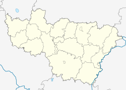
Kolobrodovo
Appearance
Kolobrodovo
Колобродово | |
|---|---|
Village | |
| Coordinates: 56°02′N 39°20′E / 56.033°N 39.333°E[1] | |
| Country | Russia |
| Region | Vladimir Oblast |
| District | Petushinsky District |
| Time zone | UTC+3:00 |
Kolobrodovo (Template:Lang-ru) is a rural locality (a village) in Petushinskoye Rural Settlement, Petushinsky District, Vladimir Oblast, Russia. The population was 3 as of 2010.[2]
Geography
Kolobrodovo is located on the Kuchebishch River, 28 km northwest of Petushki (the district's administrative centre) by road. Zhary is the nearest rural locality.[3]


