
Horka I
Horka I | |
|---|---|
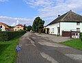
 Northern part of the village | |
 Flag  Coat of arms | |
 Horka I Location in the Czech Republic | |
| Coordinates: 49°58′58″N 15°26′24″E / 49.98278°N 15.44000°E | |
| Country | |
| Region | Central Bohemian |
| District | Kutná Hora |
| First mentioned | 1318 |
| Area | |
| • Total | 6.94 km2 (2.68 sq mi) |
| Elevation | 211 m (692 ft) |
| Population (2023-01-01)[1] | |
| • Total | 395 |
| • Density | 57/km2 (150/sq mi) |
| Time zone | UTC+1 (CET) |
| • Summer (DST) | UTC+2 (CEST) |
| Postal code | 286 01 |
| Website | www |
Horka I is a municipality and village in Kutná Hora District in the Central Bohemian Region of the Czech Republic. It has about 400 inhabitants.
The Roman numeral in the name serves to distinguish it from the nearby municipality of the same name, Horka II.
Administrative parts
Villages of Borek and Svobodná Ves are administrative parts of Horka I.
Gallery
-
 Restaurant
 -
 Small pond


References
Wikimedia Commons has media related to Horka I.
| Authority control databases: National |
|---|
This Central Bohemian Region location article is a stub. You can help Wikipedia by expanding it. |