Guri i Kuq
Appearance
| Guri i Kuq | |
|---|---|
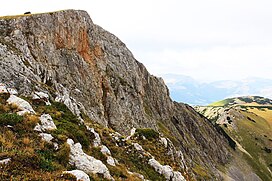
 Guri i Kuq, the highest summit in Rugova Gorge. | |
| Highest point | |
| Elevation | 2,522 m (8,274 ft) |
| Coordinates | 42°39′47″N 20°08′04″E / 42.66306°N 20.13444°E |
| Geography | |
| Country | Kosovo |
| Parent range | Albanian Alps |
 | |
Guri i Kuq (Albanian: Guri i Kuq or Guri i Verdhë; Serbian: Жути камен, Žuti kamen, translated as "yellow rock") is a mountain in the Prokletije in Kosovo. Reaching a height of 2,522 m (8,274 ft) high, it is one of the highest mountains in the range.[1] North of the mountain is the Rugova Canyon. The Kopranik mountain are located just east of Žuti kamen.[citation needed] There is a lake near the summit of the mountain, the Guri i Kuq Lake.
References
- ^ Hajla/Hajle Summit (Vrh Hajle) at summitpost.org


