Horní Kruty
Appearance
Horní Kruty | |
|---|---|
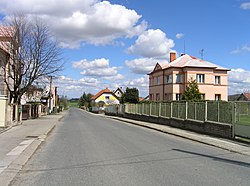
 Main road | |
| Coordinates: 49°55′10″N 14°57′35″E / 49.91944°N 14.95972°E | |
| Country | |
| Region | Central Bohemian |
| District | Kolín |
| First mentioned | 1228 |
| Area | |
| • Total | 14.34 km2 (5.54 sq mi) |
| Elevation | 408 m (1,339 ft) |
| Population (2023-01-01)[1] | |
| • Total | 513 |
| • Density | 36/km2 (93/sq mi) |
| Time zone | UTC+1 (CET) |
| • Summer (DST) | UTC+2 (CEST) |
| Postal codes | 281 46, 281 63 |
| Website | www |
Horní Kruty is a municipality and village in Kolín District in the Central Bohemian Region of the Czech Republic. It has about 500 inhabitants.
Administrative parts
Villages of Bohouňovice II, Dolní Kruty, Přestavlky and Újezdec are administrative parts of Horní Kruty.
History
The first written mention of Horní Kruty is from 1228.[2]
Gallery
-
Centre of Horní Kruty
-
Water tower
References
- ^ "Population of Municipalities – 1 January 2023". Czech Statistical Office. 2023-05-23.
- ^ "Historie" (in Czech). Obec Horní Kruty. Retrieved 2022-03-28.
External links
Wikimedia Commons has media related to Horní Kruty.


