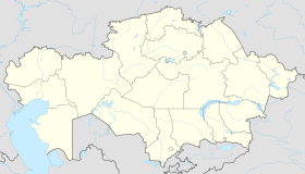
Yegindybulak
Yegindybulak | |
|---|---|
| Coordinates: 49°47′08″N 76°23′07″E / 49.78556°N 76.38528°E | |
| Country | Kazakhstan |
| Region | Karaganda Region |
| District | Karkaraly District |
| Population (2009) | |
| • Total | 3,399 |
| Time zone | UTC+6 (UTC +6) |
| Postcode | 100810 |
| Area code | +7 72147 |
Yegindybulak (Kazakh: Егіндібұлақ, Egindibulaq) is a settlement in Karkaraly District, Karaganda Region, Kazakhstan.[1] It is the administrative center of the Yegindybulak Rural District (KATO code - 354851100).[2] Population: 3,399 (2009 Census results);[3] 4,165 (1999 Census results).[3][4]
History
The Koyandy Fair, a large annual trade fair held every June from 1848 to 1930, was located near modern-day Yegindybulak on the caravan route from Central Asia to Siberia.[5] Yegindybulak was the administrative center of Kazybekbi District, an administrative division of the Karaganda Region from 1928 to 1963 and again between 1964 and 1997.[6]
Geography
Yegindybulak is located on a dry steppe area at the feet of Mount Ku. The terrain to the north of the town is mountainous. Lake Balyktykol lies 30 kilometers (19 mi) to the west. Nearby settlements include Karabulak (west southwest), Terekti (northwest), Osibay (northeast), and Kiikqashqan and Dogalan (southeast).[7]
References
- ^ Saul Bernard Cohen (2008). The Columbia Gazetteer of the World: P to Z. Columbia University Press. ISBN 978-0-231-14554-1. Retrieved 1 September 2012.
- ^ "База КАТО". Агентство Республики Казахстан по статистике. Archived from the original on 27 September 2013.
- ^ a b "Население Республики Казахстан" [Population of the Republic of Kazakhstan] (in Russian). Департамент социальной и демографической статистики. Retrieved 8 December 2013.
- ^ "Итоги Национальной переписи населения Республики Казахстан 2009 года" (PDF). Агентство Республики Казахстан по статистике. Archived from the original (PDF) on 27 February 2013.
- ^ Central Asian review. Published by the Central Asian Research Centre in association with the Soviet Affairs Study Group, St. Antony's College, Oxford. 1 January 1962. Retrieved 8 August 2010.
- ^ Справочник по истории административно-территориального устройства Карагандинской области. — Караганда: Государственный архив Карагандинской области, 2006
- ^ "Map of Egindibulaq". TopoMapper. Atlogis. Retrieved 13 September 2012.
External links
- БЕК КАРИПБЕК (4 April 2012). "Views around Yegindybulak". YouTube. Retrieved 1 September 2012.

