
Cimarron Township, Gray County, Kansas
Cimarron Township | |
|---|---|
 Location in Gray County | |
| Coordinates: 37°47′35″N 100°19′27″W / 37.79306°N 100.32417°W | |
| Country | United States |
| State | Kansas |
| County | Gray |
| Area | |
| • Total | 98.28 sq mi (254.54 km2) |
| • Land | 98.25 sq mi (254.47 km2) |
| • Water | 0.03 sq mi (0.07 km2) 0.03% |
| Elevation | 2,598 ft (792 m) |
| Population (2000) | |
| • Total | 2,379 |
| • Density | 24.2/sq mi (9.3/km2) |
| GNIS feature ID | 0471651 |
Cimarron Township is a township in Gray County, Kansas, USA. As of the 2000 census, its population was 2,379.
Geography
[edit]Cimarron Township covers an area of 98.28 square miles (254.5 km2) and contains one incorporated settlement, Cimarron, which is also the county seat.
Transportation
[edit]Cimarron Township contains one airport or landing strip, Cimarron Municipal Airport.
References
[edit]External links
[edit]Municipalities and communities of Gray County, Kansas, United States | ||
|---|---|---|
| Cities | 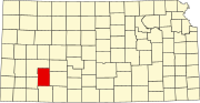 | |
| Unincorporated communities | ||
| Townships | ||
This article about a location in Gray County, Kansas is a stub. You can help Wikipedia by expanding it. |