
New Hope, Florida
New Hope, Florida | |
|---|---|
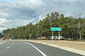
 New Hope on SR79 in 2017 | |
 New Hope, Florida | |
| Coordinates: 30°34′40.78″N 85°48′33.51″W / 30.5779944°N 85.8093083°W | |
| Country | United States |
| State | Florida |
| County | Washington |
| Time zone | UTC-5 (Central (CST)) |
| • Summer (DST) | UTC-4 (EDT) |
| ZIP code | 32428 |
| Area code | 850 |
New Hope is an unincorporated community in Washington County, Florida, United States. It is located on State Road 79.
Geography
[edit]New Hope is located at 30°34′40.78″N 85°48′33.51″W / 30.5779944°N 85.8093083°W.[1]
Images
[edit]-
 Sign on SR79
 -
 New Hope United Methodist Church


References
[edit]- ^ "US Gazetteer files: 2010, 2000, and 1990". United States Census Bureau. February 12, 2011. Retrieved April 23, 2011.
Municipalities and communities of Washington County, Florida, United States | ||
|---|---|---|
| Cities |  | |
| Towns | ||
| Unincorporated communities | ||