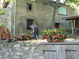
Le Sauze-du-Lac
Appearance
Le Sauze-du-Lac | |
|---|---|
 A view within Le Sauze-du-Lac | |
| Coordinates: 44°28′45″N 6°18′53″E / 44.4792°N 6.3147°E | |
| Country | France |
| Region | Provence-Alpes-Côte d'Azur |
| Department | Hautes-Alpes |
| Arrondissement | Gap |
| Canton | Chorges |
| Government | |
| • Mayor (2020–2026) | Bernard Raizer[1] |
| Area 1 | 8.49 km2 (3.28 sq mi) |
| Population (2021)[2] | 153 |
| • Density | 18/km2 (47/sq mi) |
| Time zone | UTC+01:00 (CET) |
| • Summer (DST) | UTC+02:00 (CEST) |
| INSEE/Postal code | 05163 /05160 |
| Elevation | 770–1,300 m (2,530–4,270 ft) (avg. 1,052 m or 3,451 ft) |
| 1 French Land Register data, which excludes lakes, ponds, glaciers > 1 km2 (0.386 sq mi or 247 acres) and river estuaries. | |
Le Sauze-du-Lac (French pronunciation: [lə soz dy lak], literally Le Sauze of the Lake; Occitan: Lo Sause dau Lac) is a commune in the Hautes-Alpes department in southeastern France.
Population
| Year | Pop. | ±% |
|---|---|---|
| 1962 | 70 | — |
| 1968 | 72 | +2.9% |
| 1975 | 68 | −5.6% |
| 1982 | 55 | −19.1% |
| 1990 | 72 | +30.9% |
| 1999 | 87 | +20.8% |
| 2008 | 124 | +42.5% |
History
Le Sauze du Lac, previously just Le Sauze, is located above the Lac de Serre Poncon. The village was moved after its original site was flooded by the lake in the early 1960s.
Geography
Le Sauze sits above the two branches of the Lac de Serre Poncon, previously the confluence of the Ubaye and Durance rivers. It sits below the Grand Morgon mountain.
See also
References
- ^ "Répertoire national des élus: les maires". data.gouv.fr, Plateforme ouverte des données publiques françaises (in French). 2 December 2020.
- ^ "Populations légales 2021" (in French). The National Institute of Statistics and Economic Studies. 28 December 2023.
External links
Wikimedia Commons has media related to Le Sauze-du-Lac.


