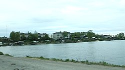
Shunga, Republic of Karelia
Appearance
You can help expand this article with text translated from the corresponding article in Finnish. (June 2023) Click [show] for important translation instructions.
|
Shunga
Шуньга | |
|---|---|
 Shunga village, Republic of Karelia. View from the side of the Putkozero | |
| Coordinates: 62°35′N 34°56′E / 62.583°N 34.933°E | |
| Country | Russia |
| Federal subject | Republic of Karelia |
| Administrative district | Medvezhyegorsky District[1] |
| Population | |
| • Total | 596 |
| • Municipal district | Medvezhyegorsky Municipal District |
| • Rural settlement | Shungskoye Rural Settlement |
| • Capital of | Shungskoye Rural Settlement[3] |
| Time zone | UTC+3 (UTC+03:00 |
| Postal code(s)[5] | 186304 |
| OKTMO ID | 86624470101 |
Shunga (Russian: Шуньга; Karelian: Šun’ga; Finnish: Sunku) is a large village in the Zaonezhie peninsula by Lake Putkozero in Russia's Republic of Karelia. It is part of Medvezhyegorsky District and is located around 50 km from the district capital, Medvezhyegorsk. The min
eraloid Shungite is named after this village as it was first described based on deposits found nearby.[6][7]
References
- ^ a b c Государственный комитет Российской Федерации по статистике. Комитет Российской Федерации по стандартизации, метрологии и сертификации. №ОК 019-95 1 января 1997 г. «Общероссийский классификатор объектов административно-территориального деления. Код 86224000135», в ред. изменения №278/2015 от 1 января 2016 г.. (State Statistics Committee of the Russian Federation. Committee of the Russian Federation on Standardization, Metrology, and Certification. #OK 019-95 January 1, 1997 Russian Classification of Objects of Administrative Division (OKATO). Code 86224000135, as amended by the Amendment #278/2015 of January 1, 2016. ).
- ^ Russian Federal State Statistics Service (2011). Всероссийская перепись населения 2010 года. Том 1 [2010 All-Russian Population Census, vol. 1]. Всероссийская перепись населения 2010 года [2010 All-Russia Population Census] (in Russian). Federal State Statistics Service.
- ^ Law #871-ZRK
- ^ "Об исчислении времени". Официальный интернет-портал правовой информации (in Russian). 3 June 2011. Retrieved 19 January 2019.
- ^ Почта России. Информационно-вычислительный центр ОАСУ РПО. (Russian Post). Поиск объектов почтовой связи (Postal Objects Search) (in Russian)
- ^ "Shunga". Karelia Tourist Portal. Retrieved 28 July 2015.
- ^ Amato, I. (10 July 1992). "A First Sighting of Buckyballs in the Wild". Science. 257 (5067): 167–167. doi:10.1126/science.257.5067.167. JSTOR 2877518. PMID 17794747.


