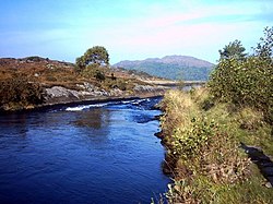
River Shiel
Appearance
| River Shiel | |
|---|---|
 | |
| Location | |
| Country | Scotland |
| Physical characteristics | |
| Mouth | |
• location | Dorlin |
The River Shiel (Scottish Gaelic: Abhainn Seile) is a four kilometre long river in Acharacle, Highland. It flows out of the Loch Shiel into the sea at Dorlin.
Fishing
[edit]The river contains salmon and sea trout, as well as native resident brown trout weighing up to 6 pounds.
References
[edit]External links
[edit]![]() Media related to River Shiel (Acharacle) at Wikimedia Commons
Media related to River Shiel (Acharacle) at Wikimedia Commons
56°45′25″N 5°49′00″W / 56.75694°N 5.81667°W
