Jibondo Island
Appearance
 House widow on Jibondo Island | |
| Geography | |
|---|---|
| Location | Sea of Zanj |
| Coordinates | 8°0′8.64″S 39°46′50.52″E / 8.0024000°S 39.7807000°E |
| Archipelago | The Mafia Archipelago |
| Length | 3.2 km (1.99 mi) |
| Width | 3.2 km (1.99 mi) |
| Administration | |
| Region | Pwani Region |
| District | Mafia District |
| Ward | Jibondo |
| Demographics | |
| Languages | Swahili |
| Ethnic groups | Matumbi, Ndengereko & Rufiji |
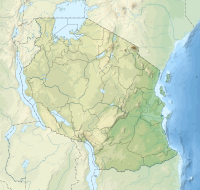
Jibondo Island (Kisiwa cha Jibondo, in Swahili) is an island of the Mafia Archipelago located in Jibondo ward of Mafia District in southern Pwani Region of Tanzania. After Juani Island, which is to its east, the island is the third largest in the archipelago. Mafia Island is to the north, and the Mafia Channel is to the west and south. Jibondo ward is named after the island. The island is part of the Mafia Island Marine Park.[1][2] A 15th-century Swahili mosque's ruins may be found on Jibondo Island, which is close to the coast.[3]
References
[edit]- ^ "The Effects of Deforestation in Mlola Forest Reserves, Mafia District, Tanzania". Retrieved 2023-09-03.
- ^ Chami, Felix A. "The Early Iron Age on Mafia island and its relationship with the mainland." AZANIA: Journal of the British Institute in Eastern Africa 34.1 (1999): 1-10.
- ^ "Kwale Island history". Retrieved 21 October 2023.

