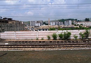
Ryongchon station
Ryongch'ŏn 룡천 | ||||||||||||||||
|---|---|---|---|---|---|---|---|---|---|---|---|---|---|---|---|---|
 | ||||||||||||||||
| Korean name | ||||||||||||||||
| Hangul | 룡천역 | |||||||||||||||
| Hanja | ||||||||||||||||
| Revised Romanization | Yongcheon-yeok | |||||||||||||||
| McCune–Reischauer | Ryongch'ŏn-yŏk | |||||||||||||||
| General information | ||||||||||||||||
| Location | Ryongch'ŏn-ŭp, Ryongch'ŏn-gun, North P'yŏngan North Korea | |||||||||||||||
| Owned by | Korean State Railway | |||||||||||||||
| Platforms | 2 (1 island) | |||||||||||||||
| Tracks | 7 | |||||||||||||||
| History | ||||||||||||||||
| Opened | 31 October 1939 | |||||||||||||||
| Electrified | yes | |||||||||||||||
| Original company | Tasado Railway | |||||||||||||||
| Services | ||||||||||||||||
| ||||||||||||||||
Ryongch'ŏn station is a railway station in Ryongch'ŏn-ŭp, Ryongch'ŏn County, North P'yŏngan Province, North Korea. It is the junction point of the P'yŏngŭi and Tasado lines of the Korean State Railway.[1]
History
The station, originally called Yangsi station, was opened on 31 October 1939 by the Tasado Railway, along with the rest of the Tasado Line from Sinŭiju to Tasado Port.[2] The Sinŭiju–Yangsi section of the line was transferred to the Chosen Government Railway as the Yangsi Line on 1 April 1943,[3] and the station received its current name in July 1945.
The Ryongch'ŏn disaster was a major accident that occurred at Ryongch'ŏn station on 22 April 2004, when a train carrying flammable cargo exploded.
Services
There are five daily return commuter trains between Ryongch'ŏn and Tasado stations.[4]
References
- ^ Kokubu, Hayato, 将軍様の鉄道 (Shōgun-sama no Tetsudō), ISBN 978-4-10-303731-6
- ^ 朝鮮總督府官報 (The Public Journal of the Governor-General of Korea), Shōwa Nr. 3841, 8 November 1939
- ^ 朝鮮總督府官報 (The Public Journal of the Governor-General of Korea), Shōwa Nr. 4837, 19 March 1943
