Shis
Appearance
Shis
شيص | |
|---|---|
| Coordinates: 25°17′26″N 56°14′44″E / 25.29056°N 56.24556°E | |
| Country | |
| Emirate | Sharjah |
| Area | |
| • Total | 19.59 km2 (7.56 sq mi) |
| Elevation | 364 m (1,197 ft) |
| Population (2017-07-01) | |
| • Total | 110 |
| • Density | 5.6/km2 (15/sq mi) |
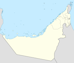
Shis (Arabic: شيص) is the name of a settlement to the East of Sharjah, United Arab Emirates (UAE). It is the westernmost district of Khor Fakkan Municipality.
The village of Shis was previously accessed only by a track leading from the East Coast up the Wadi Shis, a seasonal watercourse that passes through the Omani exclave of Madha and the Emirati exclave of Nahwa, itself enclosed by the Omani exclave.[1] The village is now reached by the Khor Fakkan road.[2][3]
It is the location of the Shees Park., a recreational facility opened in October 2020.
References
- ^ "Madha village's pledge of allegiance changed the map forever". The National. Retrieved 2018-09-19.
- ^ WAM (2018-01-07). "Sharjah Ruler inspects projects in Shis". GulfNews. Retrieved 2018-09-19.
- ^ "Sharjah - Khor Fakkan Road: Building 89km through Mountain". Al Marwan Heavy Machinery. 2023-01-16. Retrieved 2023-11-08.


