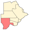
Bray, Botswana
Appearance
Bray | |
|---|---|
Village | |
| Coordinates: 25°27′04″S 23°42′26″E / 25.45120049510°S 23.70727538391°E | |
| Country | Botswana |
| District | Kgalagadi |
| Population (2011) | |
• Total | 1,041 |
| Time zone | UTC+2:00 (SAST) |
Bray is a village in Kgalagadi District of Botswana. It is located in the eastern part of the district, on the border with South Africa opposite a village of the same name in that country. The population was 1,041 in the 2011 census.[1] It has a primary school.
References
- ^ "2011 Botswana Population and Housing Census" (PDF). Retrieved 11 September 2013.


