Yumurtalık Lagoon
| Yumurtalık Lagoon | |||||||||||
|---|---|---|---|---|---|---|---|---|---|---|---|
| Template:Lang-tr | |||||||||||
 Yumurtalık Lagoon | |||||||||||
| Area | 19,853 ha (76.65 sq mi) | ||||||||||
| |||||||||||
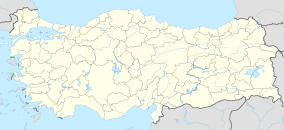
Yumurtalık Lagoon (Template:Lang-tr) is a lagoon located in Adana Province, southern Turkey. The area is a nature reserve, a national park, and is a Ramsar site.[2][3][4]
Description
The lagoon is an alluvial delta by rivers in the eastern Mediterranean Sea.[5] It is one of four lagoons in the Çukurova Delta.[6] It has 19,853 ha (49,060 acres).[5] The conservation area lies along the Taurus and Amanos mountain chains.[7] The area has both freshwater and coastal habitats, including vegetation of sand dune, salt marsh, stream bank, and ruderal types.[5] It is a key stopover and wintering site for migratory birds on the Palaearctic-Africa route.[5][8][6] Threatened species of turtles such as Caretta caretta and Chelonia mydas make their home in the lagoon; Yumurtalık Lagoon is the only known wintering site for the green sea turtle in the Mediterranean.[5][9][6]
Conservation
The site was designated as a Natural SIT Area 1st degree under the Conservation Law on Cultural and Natural Assets in 1993.[6] In 1994, it was declared a Nature Conservation Site under the Law on National Parks.[6] On July 21, 2005, it was added to the Ramsar Convention List.[6]
References
- ^ "Yumurtalik Lagoons". Ramsar Sites Information Service. Retrieved 25 April 2018.
- ^ "Yumurtalık Lagünü Milli Parkı" (in Turkish). Doğa Koruma ve Milli Parklar Genel Müdürlüğü. Retrieved 2017-01-30.
- ^ ""Yumurtalık Lagünü Milli Park olamaz"". MyNet (in Turkish). 2009-11-17. Retrieved 2017-01-30.
- ^ "Turkey - Nemrut Caldera". Ramsar. Retrieved 2017-01-30.
- ^ a b c d e "Yumurtalik Lagoons | Ramsar Sites Information Service". rsis.ramsar.org. Retrieved 2023-10-27.
- ^ a b c d e f Balli, Erdinç; Balli, Ayşe İpek Koca. "Identifying the Alternative Tourism Potential of the Lagoons of Çukurova Delta" (PDF). PMF.
- ^ ALTINÖZLÜ, HAŞİM (2004-01-01). "Flora of the Natural Conservation Area in Adana-Yumurtalık Lagoon (Turkey)". Turkish Journal of Botany. 28 (5): 491–506. ISSN 1300-008X.
- ^ Gaidet, Nicolas; Ould El Mamy, Ahmed B.; Cappelle, Julien; Caron, Alexandre; Cumming, Graeme S.; Grosbois, Vladimir; Gil, Patricia; Hammoumi, Saliha; De Almeida, Renata Servan; Fereidouni, Sasan R.; Cattoli, Giovanni; Abolnik, Celia; Mundava, Josphine; Fofana, Bouba; Ndlovu, Mduduzi; Diawara, Yelli; Hurtado, Renata; Newman, Scott H.; Dodman, Tim; Balança, Gilles (2012-09-28). "Investigating Avian Influenza Infection Hotspots in Old-World Shorebirds". PLOS ONE. 7 (9): e46049. Bibcode:2012PLoSO...746049G. doi:10.1371/journal.pone.0046049. ISSN 1932-6203. PMC 3460932. PMID 23029383.
- ^ "Alleged threats to marine turtles due to a new coal-fired power plant at Sugözü Beach - Convention on the Conservation of European Wildlife and Natural Habitats - www.coe.int". Convention on the Conservation of European Wildlife and Natural Habitats. 2021. Retrieved 2023-10-27.

