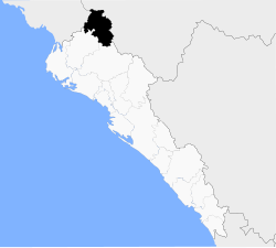
Choix Municipality
Appearance
Choix Municipality
Municipio de Choix | |
|---|---|
 Location of the municipality in Sinaloa | |
| Country | |
| State | |
| Seat | Choix |
| No. of Sindicaturas | 8 |
| Foundation | 1607 |
| Government | |
| • Municipal president | Diego Letamendi juarez |
| Area | |
| • Total | 4,512.40 km2 (1,742.25 sq mi) |
| Population (2010) | |
| • Total | 32,998[1] |
| Time zone | UTC-7 (Mountain Standard Time) |
| • Summer (DST) | UTC-6 (Mountain Daylight Time) |
| Website | Choix Government page |
The Municipality of Choix is a municipality in the Mexican state of Sinaloa in northwestern Mexico.[2] Its seat is Choix.
Political subdivision
Choix Municipality is subdivided in 8 sindicaturas:
- Aguacaliente Grande
- Baca
- Bacayopa
- Baymena
- Los Pozos
- Picachos
- San Javier
- Yecorato
References
- ^ "Main results by locality 2010". INEGI. 2010.
- ^ "-". Enciclopedia de los Municipios de México. Instituto Nacional para el Federalismo y el Desarrollo Municipal. Archived from the original on January 28, 2007. Retrieved January 11, 2010.
26°42′27″N 108°19′30″W / 26.70750°N 108.32500°W
Wikimedia Commons has media related to Choix Municipality.


