Chahains
Appearance
Chahains | |
|---|---|
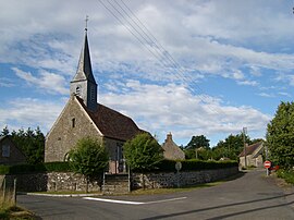
 The church in Chahains | |
| Coordinates: 48°33′46″N 0°06′46″W / 48.5628°N 0.1128°W | |
| Country | France |
| Region | Normandy |
| Department | Orne |
| Arrondissement | Alençon |
| Canton | Magny-le-Désert |
| Intercommunality | Pays fertois et Bocage carrougien |
| Government | |
| • Mayor (2020–2026) | Françoise Reig-Hamelin[1] |
| Area 1 | 7.65 km2 (2.95 sq mi) |
| Population (2021)[2] | 84 |
| • Density | 11/km2 (28/sq mi) |
| Time zone | UTC+01:00 (CET) |
| • Summer (DST) | UTC+02:00 (CEST) |
| INSEE/Postal code | 61080 /61320 |
| Elevation | 271–395 m (889–1,296 ft) (avg. 340 m or 1,120 ft) |
| 1 French Land Register data, which excludes lakes, ponds, glaciers > 1 km2 (0.386 sq mi or 247 acres) and river estuaries. | |
Chahains (French pronunciation: [ʃa.ɛ̃] ) is a commune in the Orne department in north-western France.
Geography
The commune is made up of the following collection of villages and hamlets, Le Jardin and Chahains.[3]
It is 765 hectares (3.0 sq mi) in size. The highest point in the commune is 395 metres (1,296 ft).[4]
The commune is within the Normandie-Maine Regional Natural Park and Forêt d'Écouves.[5][6]
The River Udon and 3 streams, the Grand Pied, the Moulin de Besnard and the Coupigny are the four watercourses that flow through this commune.[7]
See also
References
- ^ "Répertoire national des élus: les maires". data.gouv.fr, Plateforme ouverte des données publiques françaises (in French). 2 December 2020.
- ^ "Populations légales 2021" (in French). The National Institute of Statistics and Economic Studies. 28 December 2023.
- ^ "Chahains · 61320, France". Chahains · 61320, France.
- ^ Des villages de Cassini aux communes d'aujourd'hui: Commune data sheet Chahains, EHESS (in French).
- ^ "rapport de charte" (PDF), parc-naturel-normandie-maine.fr/
- ^ "MASSIF FORESTIER D'ECOUVES ET SES MARGES" (PDF). ZNIEFF.
- ^ "Mairie de Chahains et sa commune (61320)". Annuaire-Mairie. 26 October 2023.
Wikimedia Commons has media related to Chahains.


