
Rônai
Rônai | |
|---|---|
 The town hall in Rônai | |
Location of Rônai  | |
 Rônai  Rônai | |
| Coordinates: 48°48′51″N 0°08′06″W / 48.8142°N 0.135°W | |
| Country | France |
| Region | Normandy |
| Department | Orne |
| Arrondissement | Argentan |
| Canton | Argentan-1 |
| Intercommunality | Terres d'Argentan Interco |
| Government | |
| • Mayor (2020–2026) | Hubert Séjourné[1] |
Area 1 | 5.40 km2 (2.08 sq mi) |
| Population (2021)[2] | 179 |
| • Density | 33/km2 (86/sq mi) |
| Time zone | UTC+01:00 (CET) |
| • Summer (DST) | UTC+02:00 (CEST) |
| INSEE/Postal code | 61352 /61160 |
| Elevation | 194–260 m (636–853 ft) (avg. 218 m or 715 ft) |
| 1 French Land Register data, which excludes lakes, ponds, glaciers > 1 km2 (0.386 sq mi or 247 acres) and river estuaries. | |
Rônai (French pronunciation: [ʁonɛ] ) is a commune in the Orne department in north-western France.
Geography
[edit]The commune of Rônai borders Suisse Normande to the west of its borders.[3][4]
The commune is made up of the following collection of villages and hamlets, Rônai and Pierrefitte
Neighbouring communes[4] | |
|---|---|
-
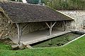 lavoir at Rônai
 -
 St-Martin fountain at Rônai
 -
 Rônai church


See also
[edit]References
[edit]- ^ "Répertoire national des élus: les maires" (in French). data.gouv.fr, Plateforme ouverte des données publiques françaises. 13 September 2022.
- ^ "Populations légales 2021" (in French). The National Institute of Statistics and Economic Studies. 28 December 2023.
- ^ "Map of Suisse Normande" (PDF).
- ^ a b "Google Maps". Google Maps.
Wikimedia Commons has media related to Rônai.
This Orne geographical article is a stub. You can help Wikipedia by expanding it. |