Ufeyn
Appearance
Ufeyn
Ufayn | |
|---|---|
District | |
 | |
 | |
| Coordinates: 10°39′00″N 49°45′00″E / 10.65000°N 49.75000°E | |
| Country | |
| Regional State | |
| Region | puntland |
| District | Ufayn District |
| Founded | 1958 |
| Government | |
| • Mayor | Ahmed Abshir Said |
| Area | |
• Total | 16 km2 (6 sq mi) |
| • Land | 137 km2 (53 sq mi) |
| Population (137,850) | |
• Total | 82,850 |
| • Density | 13/km2 (30/sq mi) |
| Time zone | UTC+3 (EAT) |
| Area code | +252 |
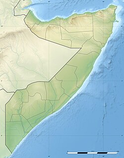
Ufeyn (in somailian Ufayn) is a district in the north-eastern Bari region of Somalia.
Location
The settlement is situated near the border with the Sanaag region in Somaliland and just off the road, between Bosaso and Iskushuban in the desert foothills on the south side of the Ahl Mescat Mountains.
Education
Ufeyn has a number of academic institutions. According to the Puntland Ministry of Education, there are 10 primary schools in the Ufeyn District. Among these are Darul Cilmi, Kobdhexad, Geesa Qabad and Jedaal .[1] Secondary schools in the area include the Abdullahi Ibrahim Secondary.[2]
Notes
- ^ "Puntland - Primary schools". Ministry of Education of Puntland. Retrieved 26 May 2013.
- ^ "Puntland - Secondary schools". Ministry of Education of Puntland. Retrieved 26 May 2013.


