Saint Landry, Louisiana
Appearance
Saint Landry, Louisiana | |
|---|---|
| Coordinates: 30°50′40″N 92°15′28″W / 30.84444°N 92.25778°W | |
| Country | United States |
| State | Louisiana |
| Parish | Evangeline |
| Elevation | 49 ft (15 m) |
| Time zone | UTC-6 (Central (CST)) |
| • Summer (DST) | UTC-5 (CDT) |
| ZIP code | 71367 |
| Area code | 318 |
| GNIS feature ID | 538931[1] |
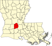
Saint Landry is an unincorporated community in Evangeline Parish, Louisiana, United States.[1] Its ZIP code is 71367.[2]
Notes
[edit]- ^ a b "Saint Landry, Louisiana". Geographic Names Information System. United States Geological Survey, United States Department of the Interior.
- ^ United States Postal Service (2012). "USPS - Look Up a ZIP Code". Retrieved February 15, 2012.


