Robinsons Landing Marina
| Robinsons Landing Marina | |
|---|---|
 Robinsons Landing Marina in Oklahoma | |
| Location | Comanche County, Oklahoma |
| Coordinates | 34°46′37″N 98°31′49″W / 34.77694°N 98.53028°W |
| Type |
|
| Part of | Lake Lawtonka |
| Primary inflows | Medicine Creek |
| Primary outflows | Medicine Creek |
| Managing agency | City of Lawton |
| Built | 1905 |
| Surface elevation | 1,348 ft (411 m) |
| Settlements | |
| Website | Robinson's Landing Marina |
Robinsons Landing Marina is located in Comanche County, Oklahoma within the continental United States.[1] Lake Lawtonka provides the fresh water source for the waterfront marina situated in the north shoreline boundaries of the Lawtonka reservoir.[2]
The public marina borders the Wichita Mountains and Wichita Mountains Wildlife Refuge with the lofty neighbor of Mount Scott in the distance. The lake marina has a census-designated place or housing estate bearing north known as Lawtonka Acres.
The Lawtonka recreation area and north shore marina are public property of the City of Lawton Lakes Division.[3]
Gallery
-
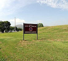
Robinsons Landing managed by City of Lawton
-
Primitive camping at Robinsons Landing Park
-
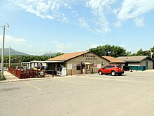
General store and recreational permits information at Robinsons Landing Marina
-
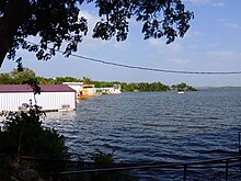
Boathouses at Robinsons Landing Marina
-
Fishing regulations for Lake Lawtonka
-
Marina boathouse construction with pictorial of Mountain Scott
Climate
According to the Köppen climate classification system, Wichita Mountains region has a humid subtropical climate, with a climate map reference as Cfa.
| Climate data for Wichita Mountain WLR, OK US (1981-2010) | |||||||||||||
|---|---|---|---|---|---|---|---|---|---|---|---|---|---|
| Month | Jan | Feb | Mar | Apr | May | Jun | Jul | Aug | Sep | Oct | Nov | Dec | Year |
| Mean daily maximum °F (°C) | 50.8 (10.4) |
54.5 (12.5) |
63.4 (17.4) |
72.6 (22.6) |
80.3 (26.8) |
88.2 (31.2) |
94.1 (34.5) |
93.9 (34.4) |
85.2 (29.6) |
74.2 (23.4) |
62 (17) |
50.9 (10.5) |
72.5 (22.5) |
| Mean daily minimum °F (°C) | 28.2 (−2.1) |
32 (0) |
40.5 (4.7) |
48.9 (9.4) |
59.1 (15.1) |
67.4 (19.7) |
71.9 (22.2) |
70.6 (21.4) |
62 (17) |
50.7 (10.4) |
39.8 (4.3) |
29.5 (−1.4) |
50.1 (10.1) |
| Average precipitation inches (mm) | 1.68 (43) |
1.81 (46) |
2.89 (73) |
2.86 (73) |
4.7 (120) |
4.5 (110) |
2.85 (72) |
3.10 (79) |
3.80 (97) |
3.75 (95) |
2.23 (57) |
1.73 (44) |
35.9 (909) |
| Source: NOAA National Climatic Data Center[4] | |||||||||||||
See also
- Cache Creek
- Charon Gardens Wilderness Area
- Elmer Thomas Lake
- Ketch Ranch House
- Lake Jed Johnson
- Mount Pinchot
- Quanah Parker Lake
References
- ^ U.S. Geological Survey Geographic Names Information System: Robinson Landing
- ^ Ellenbrook, Edward Charles (1984). "Outdoor and Trail Guide to the Wichita Mountains of Southwest Oklahoma". In-The-Valley-of-the-Wichitas House. p. 93. ISBN 978-0941634014. OCLC 11800845.
- ^ "City of Lawton Lakes Division". City of Lawton Departments. City of Lawton.
- ^ "Climatological Information for Wichita Mountain WLR, OK", NCDC Climate Data, 2020. Web: Wichita Mountain WLR, OK US.
Reading Bibliography
- Ellenbrook, Edward Charles (1988). "Endless Encounters: A Map and Recreational Guide to the Wichita Mountains". In-The-Valley-of-the-Wichitas House. ISBN 978-0941634038. OCLC 18642411.
- Lott, David C. (June 14, 2010). "Medicine Park : Oklahoma's First Resort (Images of America)". Arcadia Publishing. ISBN 978-0738577456. OCLC 646185401.
External links
 Media related to Robinson's Landing at Wikimedia Commons
 Medicine Park travel guide from Wikivoyage
- "Lake Lawtonka Levels & Reservoir Storage". National Water Information System. United States Geological Survey.
- "Robinsons Landing Marina in Lawton, Oklahoma". CountyOffice.org. County Office.
- "Wichita Mountains Wildlife Refuge". U.S. Fish & Wildlife Service. United States Department of the Interior.


