
Pavlovo, Sofia
42°39′46″N 23°16′6″E / 42.66278°N 23.26833°E
_E1.jpg)
Pavlovo (Bulgarian: Павлово) is a southern neighbourhood of Sofia, the capital of Bulgaria. Part of the Vitosha municipality, it borders Buxton Neighbourhood to the northeast, Tsar Boris III Boulevard to the northwest, the Sofia ringroad (in this section known as the Nikola Petkov Boulevard) to the south and the Buxton Boulevard to the east. Pavlovo features mostly low - to mid-rise residential architecture, with houses and small blocks of flats dominating the skyline. The 5th Primary School and the 157th High School César Vallejo serve the neighbourhood.
Gallery
Wikimedia Commons has media related to Pavlovo (Sofia).
-
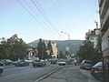
 Pavlovo along Tsar Boris III Boulevard
 -
 Pavlovo
 -
 View of Vitosha from Pavlovo along the Alexander Pushkin Boulevard


References
- "Pavlovo". Mirela.bg. Retrieved 2008-11-30.
This Bulgaria location article is a stub. You can help Wikipedia by expanding it. |