
Oszczów
Oszczów | |
|---|---|
Village | |
.jpg) Manor house in Oszczów | |
 Oszczów | |
| Coordinates: 50°33′21″N 24°2′47″E / 50.55583°N 24.04639°E | |
| Country | |
| Voivodeship | Lublin |
| County | Hrubieszów |
| Gmina | Dołhobyczów |
| Population | 40 |
Oszczów [ˈɔʂt͡ʂuf] is a village in the administrative district of Gmina Dołhobyczów, within Hrubieszów County, Lublin Voivodeship, in eastern Poland, close to the border with Ukraine.[1] It lies approximately 4 kilometres (2 mi) south of Dołhobyczów, 32 km (20 mi) south of Hrubieszów, and 129 km (80 mi) south-east of the regional capital Lublin.
The village has a population of 40.
- Sights in Oszczów
-
 Manor house in Oszczów
 -
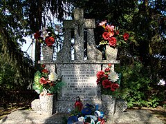 Memorial of soldiers fighting for the country and died in 1919
 -
 Monument of St. John of Nepomuk on the crossroad
 -
 Parish church
.jpg)
_-_DSC03467_v1.jpg)


References
50°33′21″N 24°2′47″E / 50.55583°N 24.04639°E
This Hrubieszów County location article is a stub. You can help Wikipedia by expanding it. |