Pompierre, Terre-de-Haut
Appearance
Pompierre | |
|---|---|
Quartier | |
 | |
| Coordinates: 15°52′19″N 61°34′15″W / 15.87194°N 61.57083°W | |
| Country | |
| Overseas department | |
| Canton | les Saintes |
| commune | Terre-de-Haut |
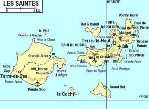
Pompierre is a quartier of Terre-de-Haut Island, located in Îles des Saintes archipelago in the Caribbean. It is located in the northeastern part of the island. The Beach of Bay of Pompierre is situated on this quartier.
