Kleiner Feldberg
Appearance
| Kleiner Feldberg | |
|---|---|
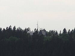
 View to the observatory | |
| Highest point | |
| Elevation | 826 m (2,710 ft) |
| Prominence | 670 m (2,200 ft) |
| Coordinates | 50°13′18″N 8°26′45″E / 50.22167°N 8.44583°E |
| Geography | |
| Location | Hesse, Germany |
| Parent range | Taunus |
The Kleiner Feldberg with an elevation of 826 metres (2,710 ft) is the second-highest mountain of the Taunus mountain range in Hesse, Germany. The Großer Feldberg is located in its immediate neighbourhood.
In 1913, a meteorological and geophysical observatory was built there by German meteorologist Franz Linke. In 1988 an astronomical observatory was built on the mountain's top. The source of the Weil River and a small castle of the Limes Germanicus are located at its northern base.
References
- Kümmerly+Frey: The New International Atlas. Rand McNally (1980)

